


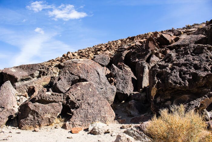
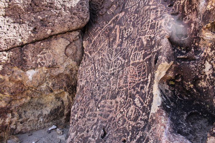
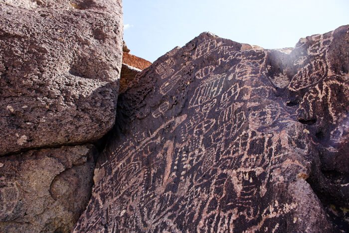
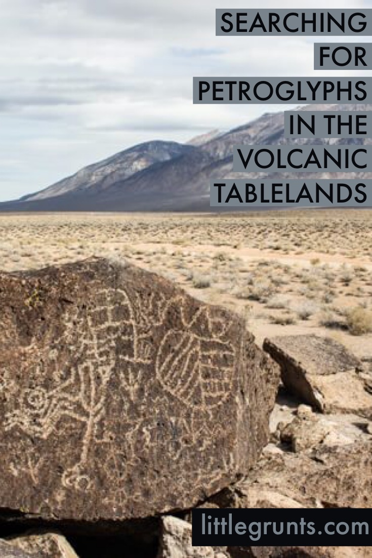
The Volcanic Tablelands is one of the coolest areas outside of Bishop. Primarily known for its climbing, specifically in the Happys and the Sads, the Volcanic Tablelands are more than that. It is home to a large collection of petroglyphs from ancestors of the Paiute-Shoshone tribe who are the original inhabitants of Payahuunadü, or the Owens Valley.
The Paiute-Shoshone were promised 67,000 acres of land in Payahuunadü, but that was revoked in favor of granting the land to the Los Angeles Department of Water and Power. The petroglyphs, however, remain scattered across the Tablelands.
The petroglyphs are no longer advertised due to destruction to the art in years past, but stop by the White Mountain Ranger Station or Wilson’s Eastside Sports for some petroglyph beta. They’ll point you in the right direction and give you some hints. Or if you prefer to do it yourself, careful sleuthing on Google will also bring up a few maps and BLM driving guides for you.

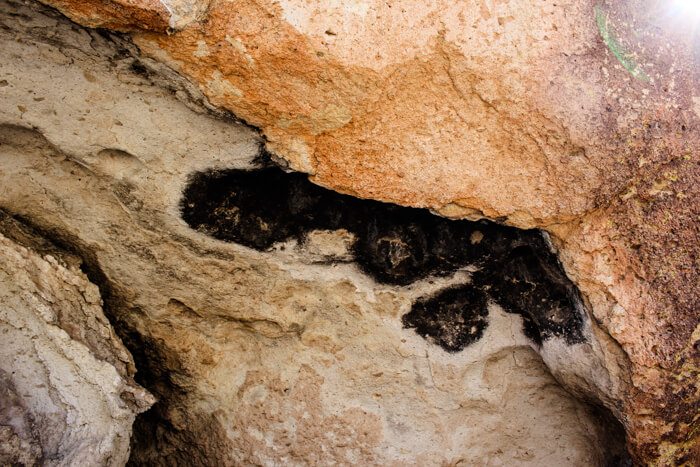
If you’re feeling more adventurous, there are tons of little dirt roads leading to cool things like this slot-like canyon. Totally worth checking out.
The easiest to find petroglyphs are located off Fish Slough Rd which runs right through the Tablelands. It’s fairly well graded and wide; you don’t need a high clearance vehicle to pass. The dirt roads that spawn off this are much less nice and should only be attempted with a 4-wheel drive vehicle and ample off-roading experience.
The sand is incredibly soft and you will get your vehicle stuck. I would know, because we got our car stuck and had to dig ourselves out.
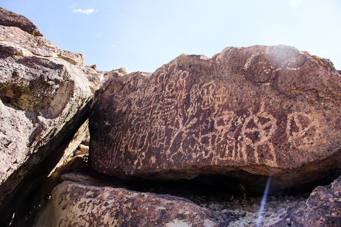
There are three main sites of petroglyphs in the Volcanic Tablelands that are well-marked by fences and turnouts. There are no real trails so most of the fun lies in wandering around from boulder to boulder hunting for the petroglyphs. Please be respectful of the rock art.
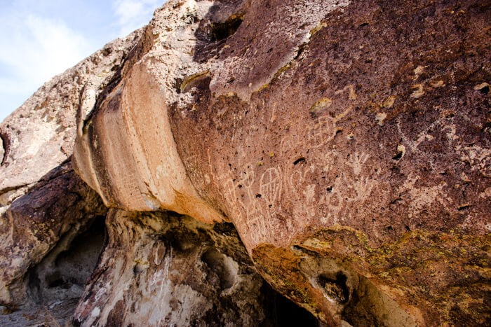
Don’t step on them. Refrain from touching. These petroglyphs have been in the Tablelands for thousands of years. Keep them that way for others to enjoy California history.
For more information on the Paiute-Shoshone tribe, please stop by the Cultural Center on W. Line Road.
Thanks to my friend Chris for his help in finding the petroglyphs!
Going north? Check out Convict Canyon or the Black Point Fissures. Find the best hot springs in Mammoth.
What else can you do on the 395? Roadtrip the Eastern Sierra in 4 days.


Last updated on September 9, 2018.
3 comments
Beautiful! I love semi-secret treasures like this.
[…] exploring and getting stuck in the Volcanic Tablelands north of Bishop, the boyfriend and I still had some time to kill. We drove south to Big Pine and […]
[…] on the Methuselah Trail but soon found that it was covered in snow, and pretty icy. Since we’d started the day in the Volcanic Tablelands before heading to Sierra View, we opted to take the Discovery Trail to not run out of daylight […]